

The data we create can be used utilized in the form of 3D photo realistic point cloud data or converted into 3D Meshes for visualization purposes. While there are many uses for this data we are currently specializing in delivering it in formats that can easily be integrated on the web for an immersive 3D experience for the user. Please note this data is not certified for any purposes or accuracy and is strictly for visualization.
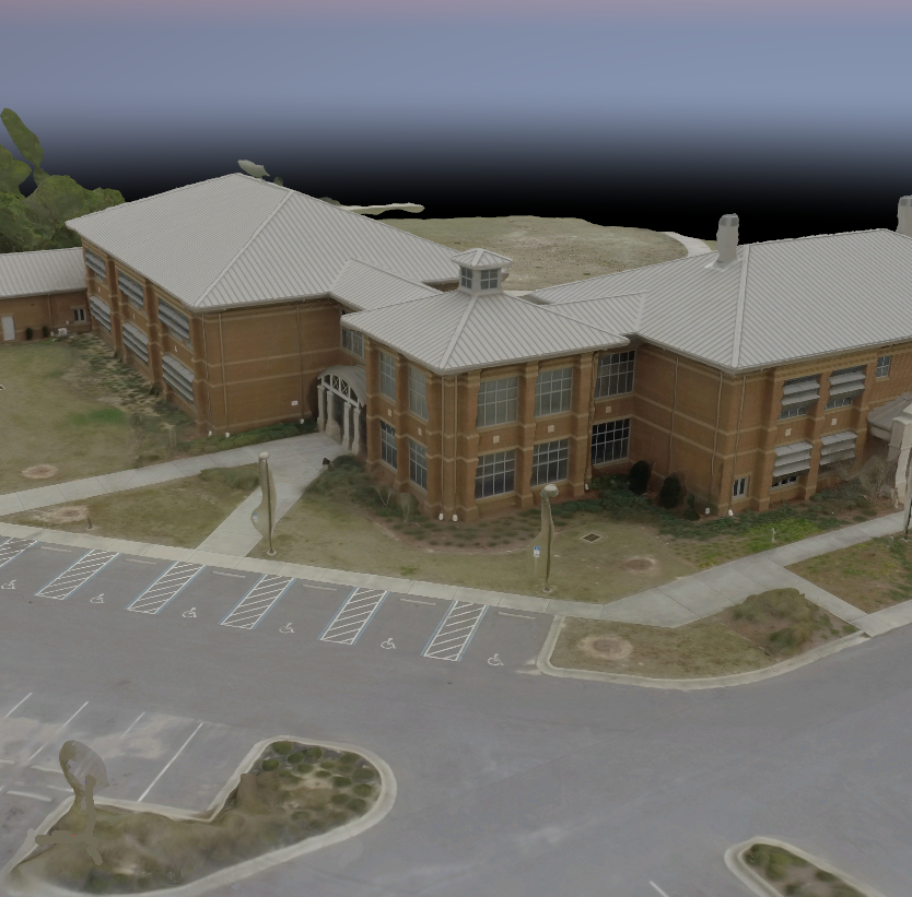
Detailed 3D Model of Building
Our 3D Models are the result of an exciting new computer vision technology called structure from motion. This 3D technology can be applied both from an aerial perspective when needing to capture buildings and landscapes or smaller features such a sculptures or other objects. While not every subject will be a good candidate due to physical limitations, many others are. This technology has been embraced by the world’s leading museums and educational facilities for the documentation and preservation of historic cultural features. We believe that this technology will also become part of a new standard for 3D web content and product marketing. Please enjoy!
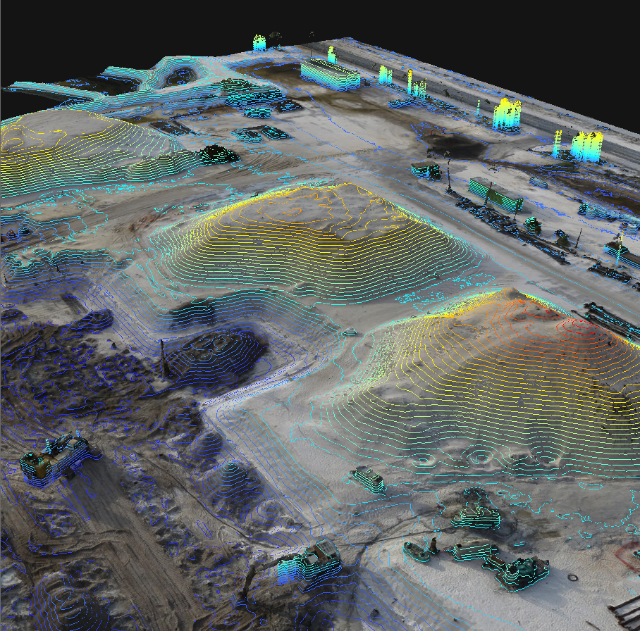
Current Construction Progress
UAVs or drones deliver the highest resolution spatial imagery that has ever been available to consumers. Coupled with the affordability and near-real time turn around, users are now able to utilize current imagery for uses never before envisioned.
Having been consumers of spatial imagery ourselves we understand the importance this high resolution and timely resource. This new epoch of aerial imagery does away with long lag time and high costs for budgeting and delivery.
Please note this data is not certified for any purposes or accuracy and is strictly for visualization.
Please visit our Aerial Image Mosaics page to view some sample data.

This graphic demonstrates the power of high resolution imagery. The traditional aerial image on the left has a 1 foot resolution and the image of the same location on the right has 1 centimeter resolution, Source: NE3RD LLC.
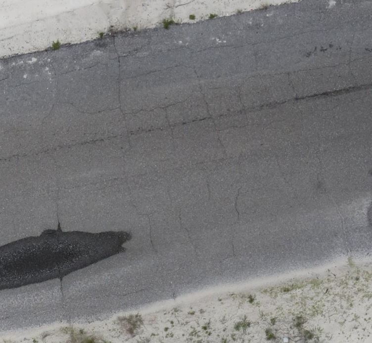
This image demonstrates the ability of high resolution aerial imagery to support infrastructure maintenance applications.
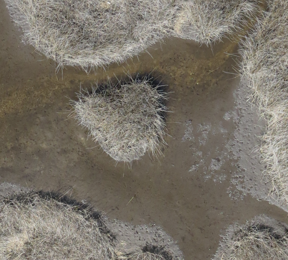
High Resolution Image of Marsh Habitat to Support Species Identification
Each project exists in a unique area with characteristics that define constraints that need to be considered during the project life cycle. A thorough understanding and compilation of data resources is a critical step when evaluating project areas for future development. Our team is highly experienced in performing the early stage “deep dive” desktop reconnaissance needed to screen for potential environmental and cultural features in a project area.
Current Construction Progress and Permit Compliance
In addition to a full suite of GIS services, ne³rd is proud to offer a full range of permitting, environmental and wetland expertise through its partnership with Peekstok Environmental Consulting LLC, which has over 30 years of experience with Florida environmental issues.
Florida environmental services include:
South Florida Water Management District (SFWMD) General Water Use permits.
Conducting wetland delineations, benthic and seagrass surveys pursuant to State and Federal criteria.
Evaluating wetlands pursuant to the Uniform Mitigation Assessment Method (UMAM), Wetland Rapid Assessment Procedure (WRAP) and Wetland Assessment Technique for Environmental Review (WATER).
Preparing environmental documents required by State, Federal and Local regulatory agencies.
Conducting monitoring efforts to comply with permit conditions.
Preparing documents for Florida Board of Trustees approval to use State Lands.
Providing listed species coordination with resource agencies.
Preparing preserve area management plans.
Developing wetland restoration plans.
Providing expert witness testimony regarding wetlands, mangroves and other marine issues.
Providing coordination with State, Federal, Regional and Local governmental agencies regarding environmental issues.
We specialize in the following aspects of geospatial environmental and cultural screening:
Data Reconnaissance
Data Modeling for Project Integration
Data Creation
Wetlands Identification and Mapping
Workflow Planning and Coordination with Field Resources
Quantification and Analysis for Reporting
GIS spatial analysis provides numerous benefits for the identification and evaluation of potential sites for real estate investment, land acquisition and/or franchise expansion. Having a comprehensive profile and spatial inventory of critical data points and business drivers are important for the success of your project is invaluable in identifying the correct Location, Location, Location.
Whether performing a detailed “slicing and dicing” of demographic data to identify neighborhood profiles, analyzing competitors, evaluating risk, analyzing drive times, or evaluating property valuations there are endless applications of how geo-spatial services can provide critical information on determining real estate purchases or investments.
We can develop customized solutions and will creatively “turn over every stone” to ensure that you have the best information available to make the right decision.
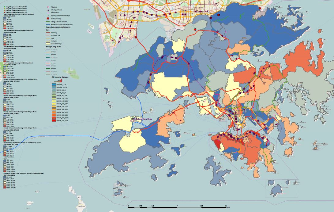
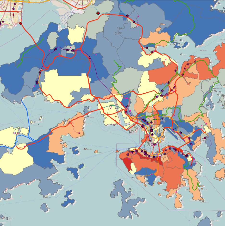
Example of multi-source spatial data resources including demographics, transportation and competitive analysis to locate the optimal dealership location in major international city
Data
Creation, Conversion and Clean-up – Do you need help converting or scrubbing data? We can help. Whether translating between formats (CAD to GIS) or generating new or revised line work, we have the tools and experience to help.
Analysis
While specializing in geo-spatial analysis we can also help with compiling other data sources (such as web data and non-spatial sources) into fused products that can be utilized in spreadsheets for analysis and report generation.
Analysis and Reports
Mapping
No map is too large or too small! We love maps and bring many years of experience in blending art and science into the products you need.
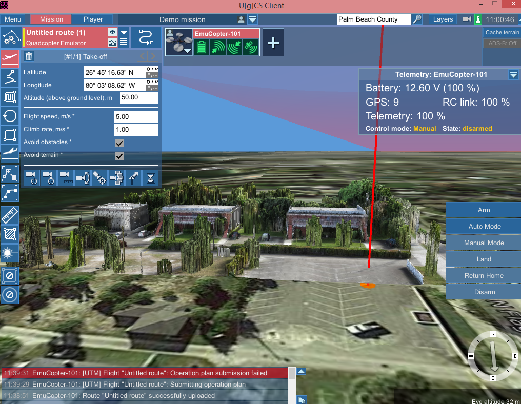
NE3RD has partnered with a team of industry and government experts to help design and test systems that will assist unmanned aerial vehicles with safe and efficient operations in the low altitude environments.
We are confident that this early planning and coordination will result in a flexible system that meets the needs of all stakeholders.
NE3RD desires to work as a conduit for entities such as large companies or municipalities interested in integrating their specific needs, data and requirements into the overall architecture of this unmanned vehicle transportation system.
Detailed Mission Flight Planning in a 3D Virtual World Environment

Our team includes some very talented programmers with years of application and web programming experience. Whether you need to streamline a clunky process or create a more sophisticated interactive web application, we can help.
Some languages include C#, Visual Basic in the .NET environment, Python and Oracle.
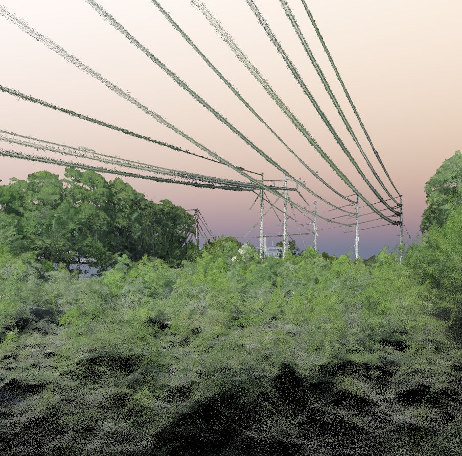
Whether connecting new sources of energy to the market or for increasing reliability, new pipelines and transmission lines are critical components to our nation’s power supply. This type of linear development is a complex and delicate endeavor requiring accurate data, analysis and intelligence for successful execution. Our team specializes in working with developers to identify potential routes and alignments based on multi-source intelligence and constraints. This approach is proven to provide the most economical, timely and politically viable solutions to our clients.
Proposed Transmission Route
Geospatial technology is a critical component in the design, creation, organization, analysis and delivery of the data needed for successful project execution. We are well versed in industry data resources, geo-physical, environmental, political, ISO information and municipal land owner data nuances.

We specialize in the following aspects of transmission line development:
Project Evaluation
Intelligence Reconnaissance
Data Acquisition and Development
Project Analysis
Site Selection
Route and Alignment Alternatives
Competitive Evaluation
Project Execution
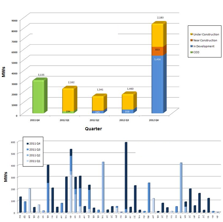
Wind and Solar energy generation is growing rapidly worldwide. Our team is proud to have directly contributed to this growth through years of experience in helping to design and develop multiple wind and solar farms across the U.S., Canada and Asia.
The development of wind energy is a dynamic process that requires agility and creativity to satisfy the economic, physical, biological, and political variables needed for a successful project. Our team specializes in delivering geospatial technology solutions to assist in this process. From early site selection and land resource development to environmental, engineering, permitting or political considerations we assist in designing and implementing spatial solutions for efficient and effective project execution. Additionally, we have partners that can provide detailed wind energy analysis and turbine layout designs for maximum project output.
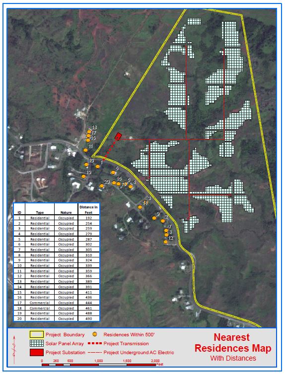
Distances of Proposed Project Improvements to Occupied Structures
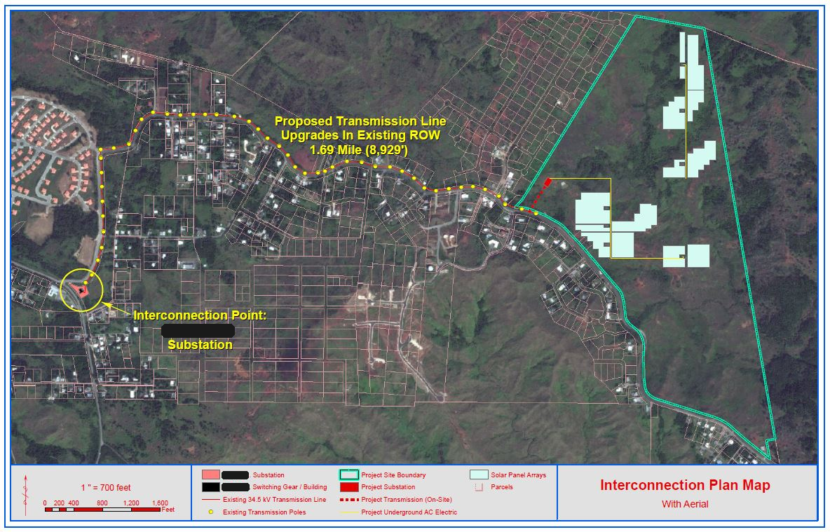
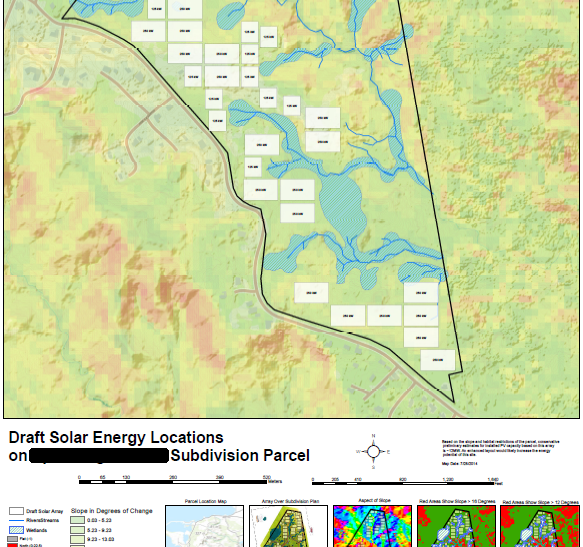
Solar energy development continues with strong growth as both small and utility scale projects are being installed globally. The development of this resource requires the addition of some unique inputs to evaluate the potential solar resource of a site based on the local weather, topography and physical characteristics of an area. By accurately modeling this solar resource by the use of geospatial technology, project developers are assured to gain the maximizing economic return from a project.
Estimating the Solar Power Potential of Site Based on Constraints
We specialize in the following aspects of wind and solar development:
Data Reconnaissance
Data Acquisition and Development
Constraints Mapping
Environmental Screening
Project Analysis
Solar Resource Modeling
Site Selection
Land Ownership Data and Land Agent Coordination
Engineering Parameters and Considerations
CAD and GIS Integration and Workflow
Competitive Evaluation
Project Execution
Drone Photography Services Navarre Florida, Drone Aerial Photography Destin Florida, Drone Aerial Photography Mobile AL, Aerial Photography Naples FL, Aerial Photography New Orleans, Drone Aerial Photography Panama City FL, Aerial Photography Pensacola, Aerial Photography West Palm Palm Beach, Drone Aerial Photography Tallahassee
Drone Photography Florida, Drone Photography Mobile AL, Drone Photography Naples FL, Drone Photography New Orleans, Drone Photography Panama City FL, Drone Photography Pensacola, Drone Photography West Palm Beach, Drone Photography Tallahassee,
GIS Mobile Alabama, GIS Panama City FL, GIS Pensacola, Pensacola GIS, Mobile GIS, Santa Rosa County GIS, Escambia County GIS, Alabama GIS, Florida GIS, West Palm Beach GIS, Gulf of Mexico GIS, Energy Development GIS, Wind Farm Development GIS, New Orleans GIS, Environmental GIS Florida,
Aerial Videography Florida,
Drone Services Alabama, Drone Services Florida, Drone Services Mobile, Alabama, Drone Services Pensacola, Drone Videography,
Florida 3D, Environmental Drones Florida, Gulf of Mexico Drones, Gulf of Mexico Aerial Photography, GIS, Florida, Energy GIS, Energy Drones, Transmission Drones,, Wind Farm Drones, Wind Farm Support, Energy Services GIS, Energy Services Drones
Florida drone automation, Florida drone mission planning, Florida drone inspections, Florida autonomous drones, Navarre Drones, Navarre Aerial Photography, Navarre GIS, Navarre Excel Support, Navarre Video, Navarre Mapping, Pensacola Mapping, Florida Agriculture Drones, Florida Insurance Drones, Florida Emergency Response Drones, Pensacola Excel Support